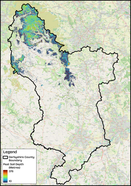
At first glance, peatlands might not seem very exciting, they’re often soggy, windswept areas hidden away in the hills. But beneath the surface, they’re one of nature’s most powerful tools in the fight against climate change. That’s because peat is made up of partly decayed plants that have built up over thousands of years, locking away huge amounts of carbon.
Thanks to a newly updated dataset from Natural England, called the England Peat Map, we now have the most accurate picture yet of where these landscapes are, how healthy they are, and how much carbon they can store.
What is the England Peat Map?
The England Peat Map, released earlier this year, is the most detailed picture of peat soils ever created in the UK. It took five years of work by scientists, ecologists, and data experts, who combined information from satellites in space, surveys on the ground, and computer models (a type of machine learning that spots patterns in big sets of data). Together, this revealed where peatlands are found, how deep the peat goes, and what plants are growing on top.
This map is already proving useful. Conservation groups, farmers, and land managers are using it to make better decisions about how to protect these carbon-rich soils and restore damaged areas.


